
Chesterfield
Conservation Commission
Welcome!
Chesterfield Conservation Commission is a town commission as authorized under RSA 36-A for the Town of Chesterfield, New Hampshire. It is an advisory and educational body.
The Chesterfield Conservation Commission focuses on environment protection, educational activities, hiking trails, enhancing visual and wildlife characteristics in town, collaborating with the zoning/planning board and assisting the State of New Hampshire through the wetland and shoreland permit process.
Chesterfield Conservation Commission meetings are held on the fourth Monday of each month at 7:30 pm at the Chesterfield Town Office (unless otherwise posted).
Our mission has been to preserve and enjoy the town’s incredible natural resource, its land. The Commission feels strongly that access to our public lands is essential to the appreciation of their value, and has helped establish and maintain trail networks throughout town. Maps are provided on this site.
Updates & Announcements

Next Commission Meeting
The next Conservation Commission meeting will be on Monday,
June 29, 2026 at 7:30 pm. Please contact Amy LaFontaine if you would like to attend and be added to the agenda.
Watershed Day
A day of exploration and appreciation of how watersheds shape,
protect, and nurture Chesterfield's amazing natural resources
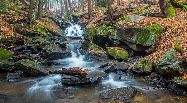
Photo by NH State Parks
The Chesterfield Conservation Commission continued its program on ecological connections and watershed health with a presentation held on May 23 by Moosewood Ecological LLC on the new Chesterfield Watershed Health Assessment Index. The well attended event was a sharing of some very informative information. View the slide show of the presentation here.
A New Picnic Table in Friedsam Town Forest
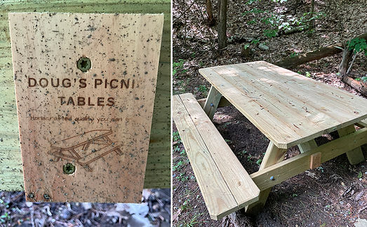
The Chesterfield Conservation Commission would like to thank Douglas Somers for his hand-made picnic table placed in the Lower Lot. Doug makes his tables in his yard in Spofford Village, often with help from his young son. If you would like to purchase or see the variety of tables he creates, he can be reached at baseballnut03440@gmail.com. Thank you Doug!
Chesterfield Town-wide Biodiversity Project
_JP.jpg)
Have you ever wondered what that strange bug crawling on the rock wall is called, or what the name of a plant is that you often see while hiking? What about that fluffy-looking moss on the side of that maple, or the energetic songbird singing away in the canopy? You can answer all these questions and more through a new, community-driven field guide of Chesterfield’s flora, fauna, and fungi. The project, called Town of Chesterfield: A Living Field Guide, collects observations of living organisms that people submit to the community-science database iNaturalist.
iNaturalist is an easy-to-use, free app that can help identify what you are seeing and hearing. When a photo or sound recording is shared to iNaturalist, expert naturalists help identify what was observed. As of April 2021, beginner and master naturalists alike have used iNaturalist to document over 300 wild species in Chesterfield. Among these, are one of New Hampshire’s only records of Wulf’s peatmoss and North America’s largest native moth, the Cecropia Moth, which has a colorful wingspan measuring seven inches.
The town-wide living field guide project arose out of a natural resource inventory conducted by Moosewood Ecological, a regional consulting group based in Chesterfield. This project, supported by the Chesterfield Conservation Commission and the Chesterfield School Outdoor Education Committee, not only contributes directly to the town-wide inventory, but participants will gain a stronger connection to nature and new discoveries await.
iNaturalist continues to deepen our understanding of nature, and many of Chesterfield’s public lands remain to be documented. Places like Friedsam Town Forest, Pisgah State Forest, and Chesterfield Gorge Natural Area eagerly await your exploration. Similarly, nature knows no bounds, and observations of wild, uncultivated plants and animals from your own yards are welcomed by the living field guide.
To learn more about this exciting project, get involved, or see a list of all 320 species, visit the project website. (Under community: projects: Town of Chesterfield)